Blog home / Traveller’s Tale: Walking The Norfolk Coast Path
Traveller's Tales: Walking the Norfolk Coast Path
Walkers' Britain & Europe traveller Peter G. Wells travelled to England and walked the Norfolk Coast Path with friends over seven days, from Great Yarmouth to Burnham Deepdale. Here is his account.
Nature, history and coastal change
In mid-April, I once again flew over the North Atlantic to England, home of my ancestors and many cousins and friends. On this trip, one objective was to hike and explore the Norfolk Coast Path. The path is one of the UK's national trails, noted for easy access, walkability, history, and exposure to some of the country's best unspoiled and biologically diverse landscapes.
The path is in the county of Norfolk, north-east of London and adjacent to the North Sea. It runs from the towns of Hopton on Sea and Great Yarmouth, just north of Lowestoft, all the way to Hunstanton on The Wash, a large coastal embayment. The path ambles along a coastal landscape of sandy and rocky beaches, extensive sand dunes, high cliffs, farm fields, salt marshes and dykes, and the waterfronts of historic Victorian towns and ancient villages. It is joined to another national path, the Peddars Way, a long ancient inland walk that follows an old Roman road through the heart of Norfolk. Together, the two paths run 216 km of fairly easy walking, a combination of flat and undulating terrain through both wildness and settled land.
Old friends and generous hosts
After a harrowing night at Heathrow Airport, where I discovered my booked hotel had been turned into a refugee centre, I travelled through London and took the train to Norwich, the capital of Norfolk. I was met at the train station by friends Graham and Jenny, who live nearby in the village of Brundall. I had met them years earlier on the South West Coast Path, and had hiked with them since. They treated me to a whirlwind tour of the historic city, after which we went to their lovely home for the night. The following day we had a break-in jaunt in county Suffolk, at the Dunwich Nature Reserve of heathlands, woods and open fields. That evening, we decided to hike the Norfolk Coast Path in seven sections, each day coming back to the house for the night. Their hospitality was very generous, and their son drove us back and forth almost every day. Better guides to Norfolk and the path could not be found anywhere.
The Norfolk Coast Path is ancient and well trodden, clearly waymarked and hence easy to follow. For the seven days of walking we were lucky with fine weather and fresh ocean breezes. We started in Great Yarmouth, after exploring the ruins of the ancient Burgh Castle, built by the Romans during their occupation of Britain.
Dunes, seals and crumbling cliffs
The first two days of the walk were mostly a slog along the top of enormous sand dunes and on beaches, both sandy and stone. Many grey seals were seen resting at the water's edge, and are a popular tourist attraction; the pups quite often wander into the dunes and are best left undisturbed. Common, or harbour, seals also thrive along the coast. We soon reached an area of high cliffs that had suffered much erosion from storms and wave action, and passed one house that had just been rescued from toppling over the edge. The beautiful village of Happisburgh is suffering from the increased erosion, often metres of land per year, and more houses and infrastructure may have to be moved soon.
Fossils, flint tools and the Deep History Coast
Several locations along the Norfolk coast are well known for their glacial geology and important fossil finds. The skeleton of a steppe mammoth was found in the cliffs of the Cromer Forest Bed at West Runton, south of the Victorian town of Cromer, and evidence of flint tools and imprints of hominid footprints, over 800,000 years old, were recently discovered on the beach at Happisburgh. The various fossils and the history of early humans are described in excellent interpretive displays along the path, in a section called the Deep History Coast, with comfortable benches for resting weary feet. Needless to say, we did not come across ancient animals or prehistoric humans on our walk, but a longer visit could have included more examination of the rocky and sedimentary cliff faces along the way, where continual coastal erosion keeps uncovering secrets of the past.
Along the path are many remnants of defensive structures dating from the Second World War, including gun emplacements, concrete walls, round pillboxes, and many beach groynes designed to prevent boat landings. Norfolk was well fortified during the war due to the expectation of an invasion, and there are also many old airfields inland, as Norfolk was home to massive squadrons of bombers and fighter planes at the time.
A family reunion in Sheringham
Upon reaching the large town of Sheringham after four days on the path, Graham left me to stay with two cousins I had not previously met, a truly memorable family occasion. They are daughters of an uncle who had survived as a prisoner of war for five years, after capture at Calais. We had much catching up to do on family history, with their photo albums at the centre of discussion.
Marshes, dykes and windmills
After that restful interlude, the three of us rejoined and continued walking westward into a coastal landscape of much transformed land. Much of this part of the coast has numerous nature reserves and sites of special scientific interest, and is rich in biodiversity. Birds of all kinds were numerous in the marshes, geese, ducks, songbirds, egrets and other long-legged coastal birds. It is a birdwatcher's wonderland, and in season many species of butterflies are seen. Numerous dykes separate the many small harbours and marshes from the farm fields.
The villages we passed through were beautiful and quaint, with much architecture reflecting the connection to the Netherlands, whose builders dug the dykes many centuries ago. A famous windmill at Cley overlooks enormous stretches of marshes and is a well known landmark. We could have spent longer exploring sites like this.
Pints, pubs and a chance encounter
In the prosperous fishing village of Wells-next-the-Sea, we met the sister and niece of a colleague of mine in a lovely old pub. At the end of a long day on the dykes, we conveyed messages from home over well-earned pints of local beer. Pubs were often the stopping place at day's end, my friends seemingly knowing the location of each of them.
The final stretch to Burnham Deepdale
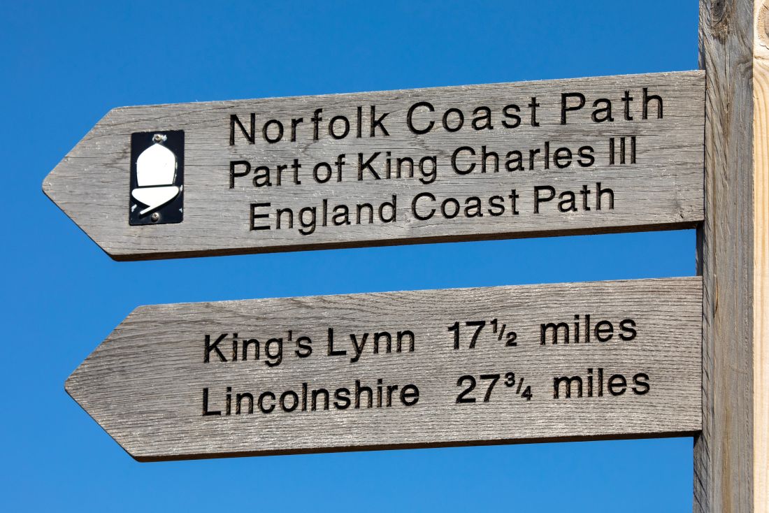
Beyond Wells-next-the-Sea lay a lifeboat station, one of many, sandy beaches lined with colourful huts popular with visitors, woods of pine trees, another huge dune system, and a long stretch of dykes. Our walk ended in the village of Burnham Deepdale, in the shadow of an ancient church. We were only one day from our planned destination of Hunstanton, but time intervened, so this stretch of the path awaits another visit. We bussed back to our meeting place for the ride to Brundall, happy with what we had accomplished over seven days, approximately 110 km, and full of good memories.
A country of endless stories
The walk has amazing variety, from quite wild stretches of coastline to historic churches, windmills, ancient villages and modern towns. It leaves one with a sense of both historic and contemporary England, a country that has endless stories to tell.
Of great current interest is how the whole Norfolk coastline is adapting to advancing climate change and a powerful ocean. Much of it is very prone to erosion, and it is in the news a lot, especially after the storms that these days frequently sweep the country. Hopefully the coastal towns and villages of Norfolk will be able to adapt and mitigate the effects of such severe and damaging storms, and preserve this wonderful coastal walk for the future.
>> Explore more walks along the King Charles III England Coast Path